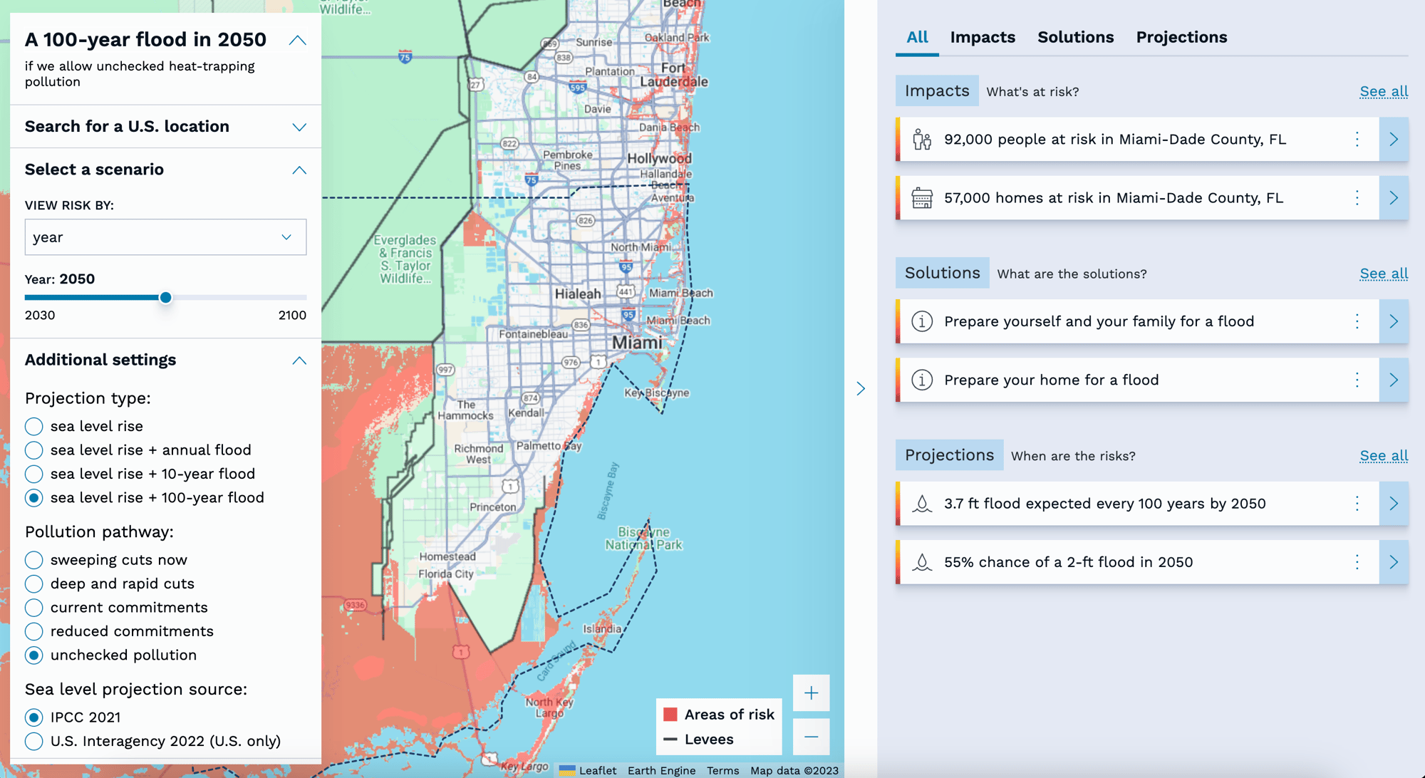
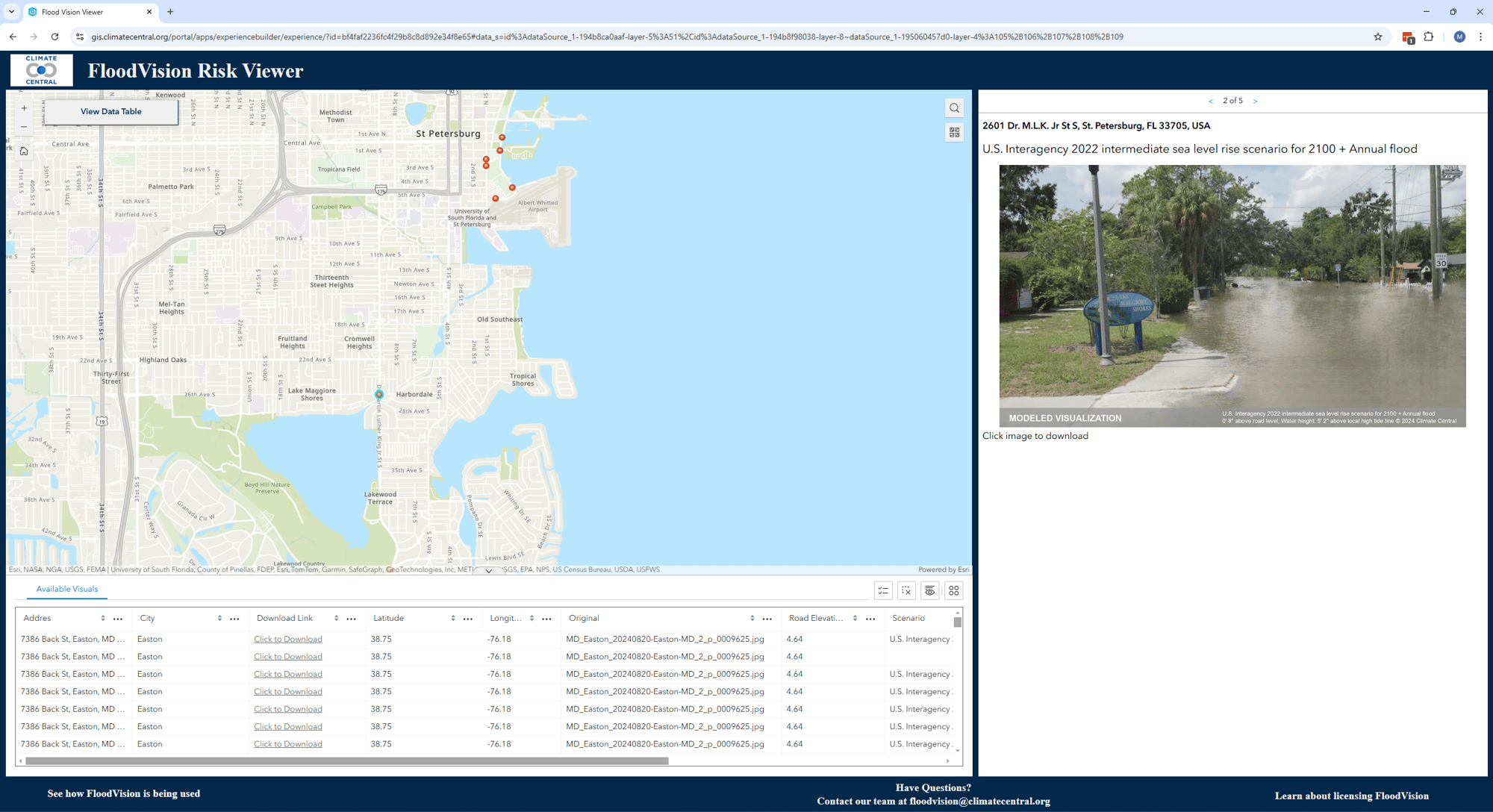
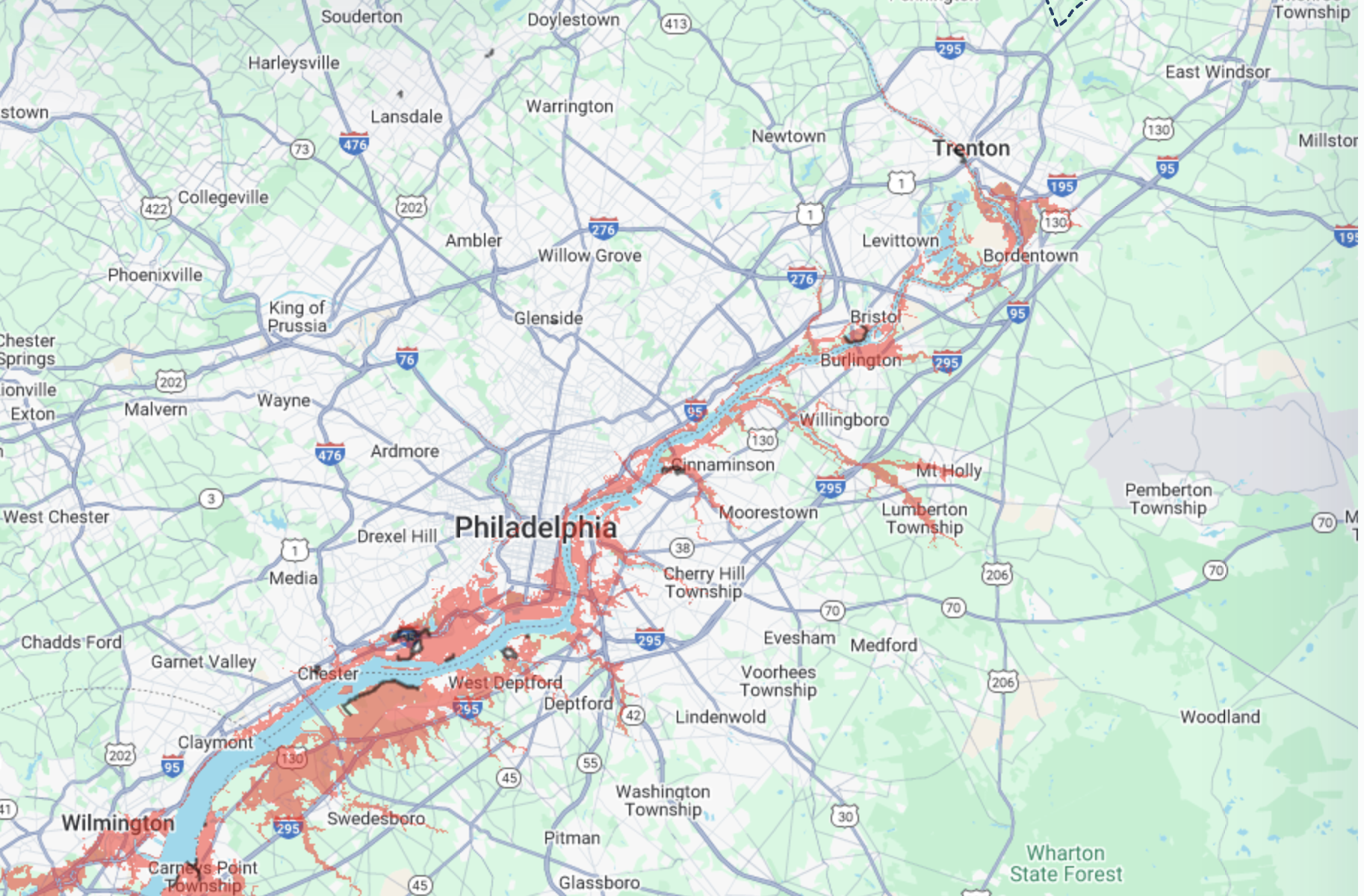
Climate Risk Tools:
Public and Commercial Offerings
Interactive, no-cost tools
Intended for non-commercial users, these tools explore a variety of climate impacts on communities.
Coastal Risk Finder
A public tool for exploring population, infrastructure, and exposure to sea level rise.
- No-cost access to interactive maps and analysis.
- Displays who and what is at risk under various sea level rise (SLR) scenarios.
- Based on peer-reviewed science and trusted federal datasets.
FloodVision®
RiskViewer
An interactive map of the US East Coast featuring high-quality visualizations of sea level rise and coastal flooding.
- Cutting-edge technology was used to create realistic visuals of various flood scenarios.
- Imagery easily downloadable for communication and outreach.
Climate Shift Index
An attribution tool showing how climate change has altered the frequency of daily temperatures globally.
- Quantifies the influence of climate change on air and sea surface temperatures.
- Helps connect climate change to weather events (e.g. extreme heat, wildfires) and impacts (e.g. school closures, health risks).
Commercial products
Built for professional use, these tools support planning, analysis, and outreach at scale.
GIS Layers
Sea Level Rise and Coastal Flood Layers
Interactive GIS-ready map layers showing potential flood extent for multiple future scenarios.
- Layers include combinations of sea level rise + storm surge / extreme tide scenarios.
- Available globally or by region.
- Useful for risk assessments, planning, and storytelling.
CoastalDEM®
A high-resolution coastal global digital elevation model tailored for coastal flood risk analysis.
- Developed using advanced machine learning to correct errors in traditional elevation data.
- Enables more accurate projections of areas exposed to sea level rise and coastal flooding.
- Available on global scale or country-by-country
FloodVision®
Photo-realistic flood visualizations and precise elevation data for decision-making and community outreach.
- Shows how flooding would actually look at street level.
- Helps identify risks and engage stakeholders with customized local visual content.
- Where available, provides entry floor elevation (EFE) data for buildings.