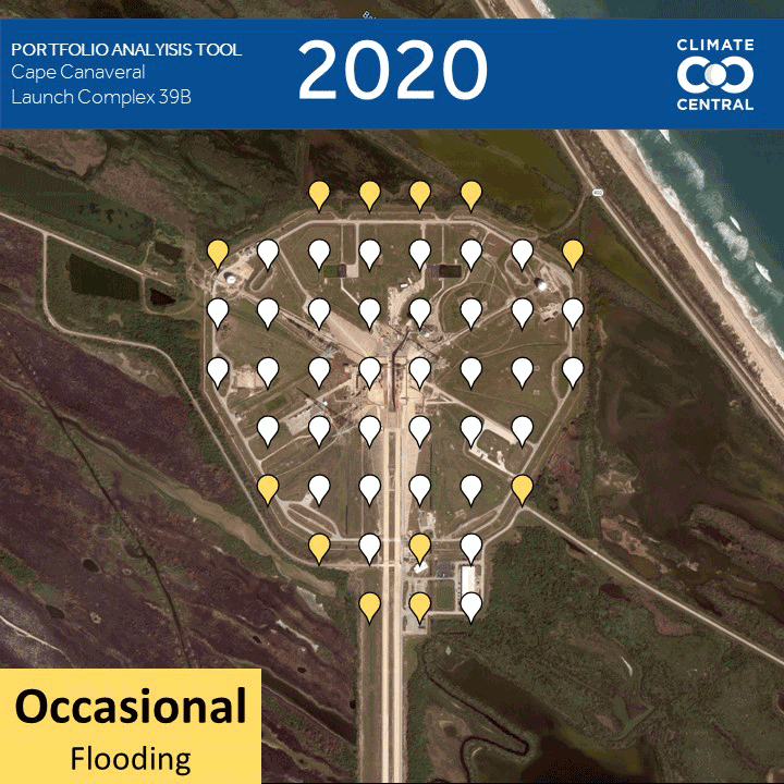
Climate Central's Portfolio Analysis Tool:
Analyzes flood risk for large amounts of locations
Provides you with scalable analysis data in an accessible package - no GIS experience needed!
Paints a clear picture of the elevation in your area
Make understanding flood risk simple.
Looking for flood data for larger areas? CoastalDEM® provides precise elevation and flood data for almost any coastal location you can think of.
Using LIDAR technology and AI-based algorithms, we've developed the flood visualization of your dreams.
Our Sea Level Rise and Coastal Flood Layers illustrate the extent and depth of present and future coastal floods.
Our tools, our community, and how we can help you.
Chat with one of our experts to see how our data can best help you, your portfolio, and your community.
Can quantify flood risk at almost any coastal location
Requires no GIS experience to download or understand!
Stands on a foundation of cutting-edge science, peer-reviewed data, and local flood history